
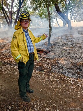
My NASA Wildfire, Ecosystem Resilience, & Risk Assessment Initiative (WERK) team arranged a field trip to visit the Mt. Tamalpais Watershed and learn about how they were managing their landscapes. As it turned out, the day of our trip coincided with a prescribed burn, so we were able to see the management in action.
We were quickly introduced to Carl Sanders, Halley, Carla, Katie, and intern Alejandra from the Marin Municipal Water District (MMWD) and Sarah from Marin County Department of Parks and Open Space before we drove down the road, parked, and encountered about 70 firefighters receiving a briefing.
We listened to the briefing and then moved to another spot where there had been a prescribed burn the previous day. There were still some spots that were smoldering and smoking. Carl explained some of the factors that go into managing prescribed burns. A burn plan includes humidity, temperature, wind, and inversion layers. While he was discussing the term potential operational delineations (PODs), or natural fire breaks like the lakes around us, one tree burst into flames (a flare up) and just as suddenly the flames went out. Carl didn't skip a beat. He said that mechanical reduction followed by fire is most effective at fuel reduction. We saw an example where trees were limbed and small madrones were cut. The branches had been placed in piles away from canopies where they would burn more completely and reduce the chance of the fire getting into the canopy. Now I know the cause of those white circles I see after a forest has burned.
We then viewed a couple of areas that had burned the previous year. The forest was very clean. One of the goals for prescribed burns is improving forest health and the results were clearly evident here. Our forests have evolved with fire set by indigenous peoples every seven years or so. Another goal is to reduce fuels at the urban interface, such as the area in which we were in. The cost of this management to the MMWD is a staggering $3.5 million per year and is supported with CAL FIRE grants.
And then we entered the area that was currently being burnt. Logs were burning, firefighters were mopping up, or ensuring things that should burn were burning and things that should not be burning were not. This was a most unusual hike.
We continued walking around the lake to see a more active portion of the burn. You can hear the fire pop and crackle in the movie below, along with Carl's description of some of things they have to keep in mind when scheduling a burn. It's quite interesting.
After enjoying the captions below, you can view larger versions of the photos by clicking on them. This will open a new tab in Google Photos. Use its menu to start a slideshow, or select a photo and press the Info button to view captions and maps.
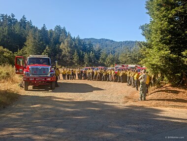
As we walked around the corner, we saw a phalanx of firefighters being briefed. |
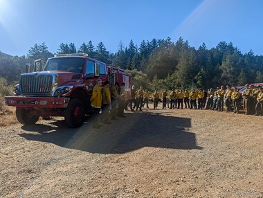
As we neared, we could see the fire chiefs who were giving the briefing. |
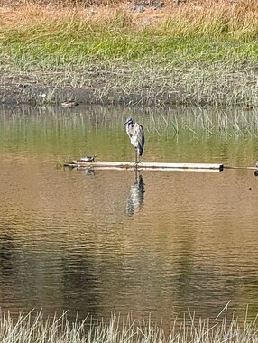
When I took the picture, I hadn't seen the turtle sharing the floating log with the
great blue heron. |
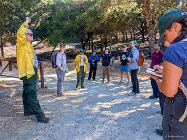
Carl Sanders describes the burn that had occurred here yesterday. |
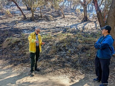
Carl tells us that pre-treatment involves limbing trees to keep the fire from moving into the canopy, and cutting small trees, madrones in this case, and creating piles away from trees. Those burnt piles cause the white circles we see in the burned area. |
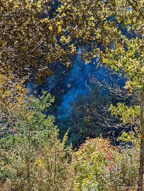
Suddenly, a tree burst into flames and just as suddenly, the flames went out. This is called a flare up. |
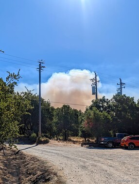
As we walked back, we could see that the burn was already in progress. |
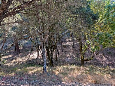
A prescribed burn occurred here last year. |
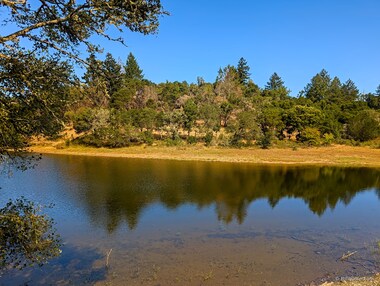
A prescribed burn occurred here last year. |
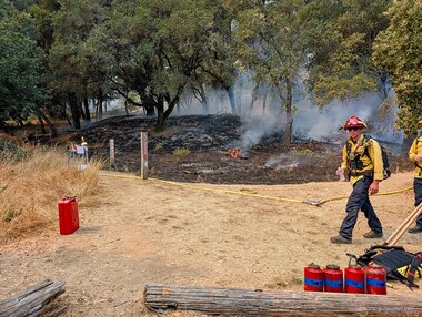
This side of the hill had already burned in the short time we were visiting yesterday's fire. |
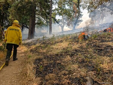
We walked up the trail by burning logs. |
Carl explains some prescribed fire techniques. |
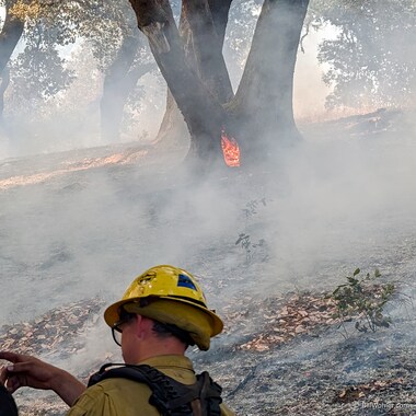
A rotten core inside of this madrone burns, and will likely accelerate the demise of the branch leaning towards us. We heard chainsaws and Carl explained that compromised trees were being felled for safety. |
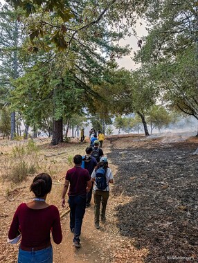
Our group continues down the trail along the black line. |
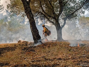
This firefighter uses his hoe to arrange burning logs in piles to help them burn more completely. I saw another firefighter use his hoe to remove duff around a large and favored tree and then apply water to protect it. |
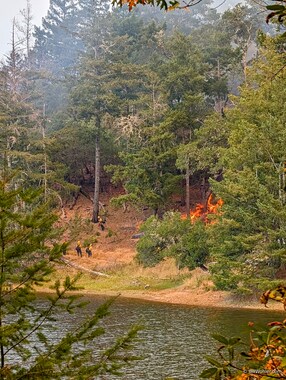
We then moved around the lake to view a more active burn. |

You can see that some of these firefighters are carrying drip torches. I thought you lit the fire at the top of the hill into the wind... |
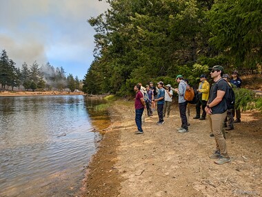
Our group listens to Carl talk about how indigenous peoples used fire to manage the landscape while the fire across the lake roared. |
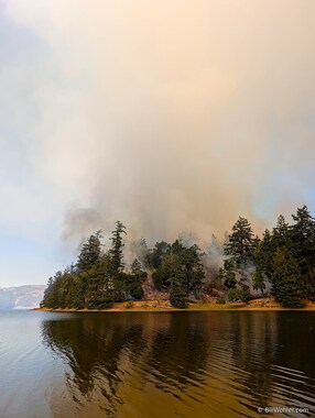
The fire generated a tall pillar of smoke. |
|
|
Copyright © 2026 Bill Wohler Last modified: Sat Sep 5 08:03:26 PM PDT 2026 About photos |


Free DNS |